Research in Practice: Urbanism and Urban Trends
Cuningham has a long history of engaging in the planning of the built environment at the urban scale, and recent R+D efforts have begun to investigate how large, public datasets can be used to guide urban planning efforts and inform design teams of the constraints related to their projects.
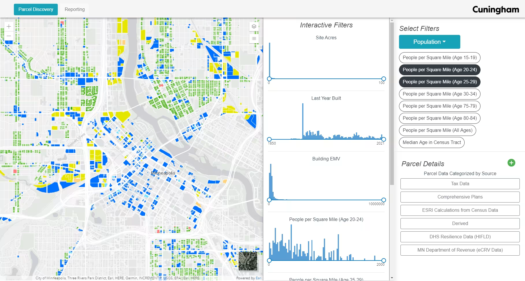
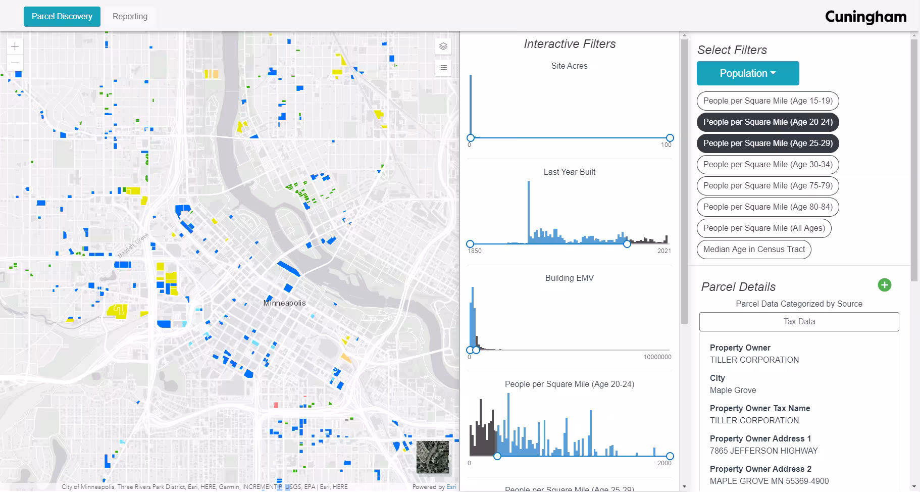
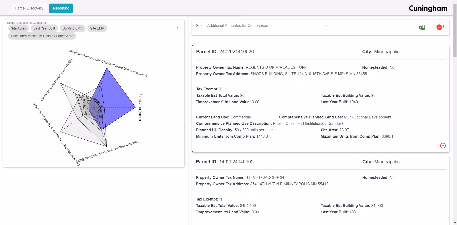
By combining data from public tax records, regional comprehensive plans, urban context, and demographic data, Cuningham produced a web application that aggregates publicly available data for Hennepin County and creates a novel way for evaluating the potential of parcels for development. While cities already publish their zoning code data, this only gives a perspective on the current state of the built environment. By using comprehensive planning data, we can gain a view into the future of a region. Comprehensive plans are the documents that cities use to plan how they will begin to change the zoning of the region, and this can be combined with the detailed information of public tax records to gain insight into parcels that have the potential to switch uses in the near future.
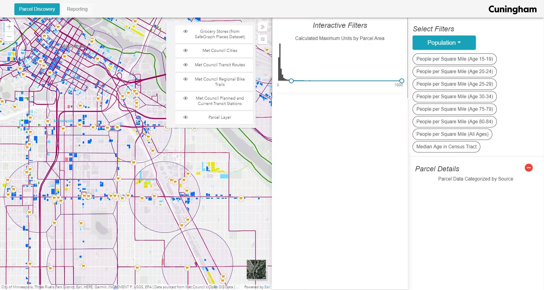
This web app looks specifically at parcels that are not currently multifamily residential but have the potential to move in that direction with new zoning codes based on comprehensive plans. Because there are quite a few parcels that meet these criteria, we added a large quantity of context data and created the ability to filter by numerous attributes simultaneously — filtering thousands of parcels down to just a few for further investigation. A side benefit of this dashboard is that it aggregates common data sources that designers reference during early planning phases.
- Image
- Image
- Image
- Image


- Image
- Image
- Image
- Image
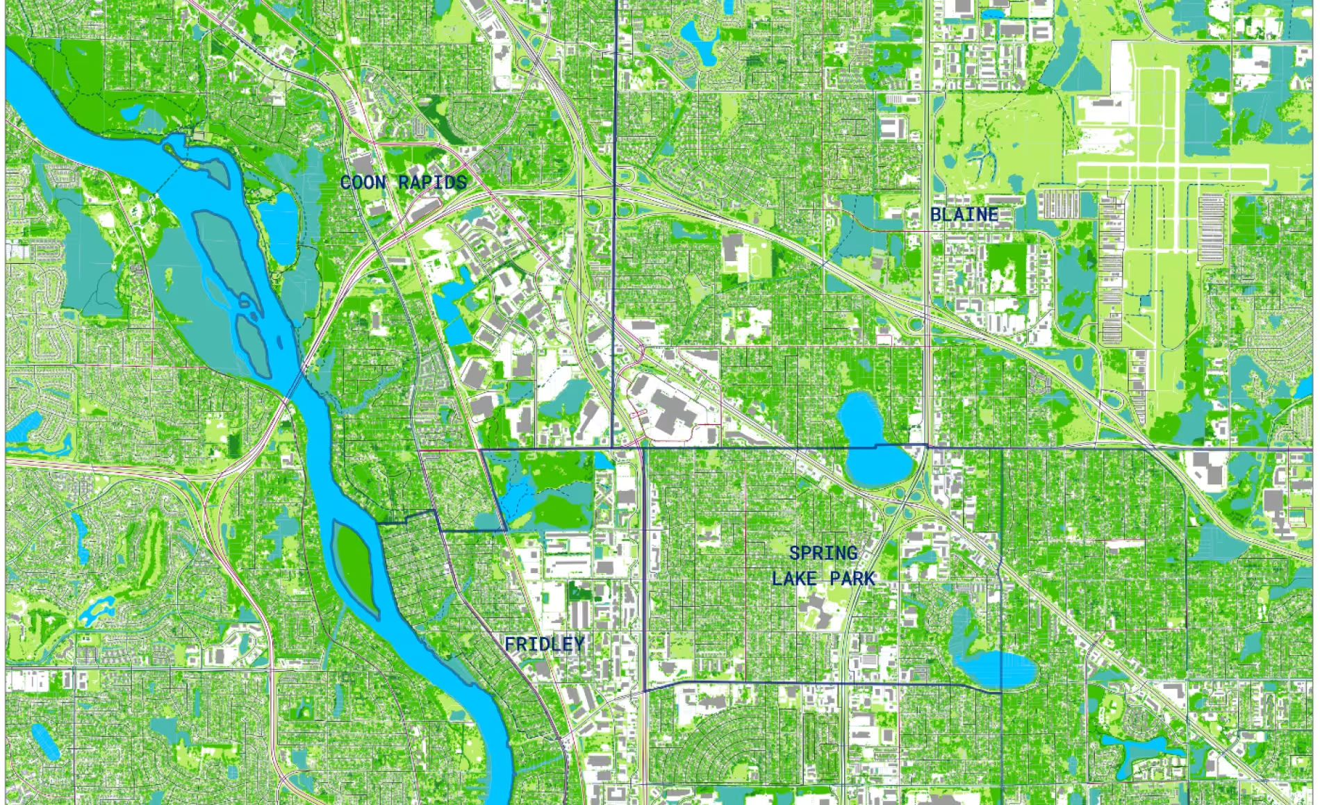
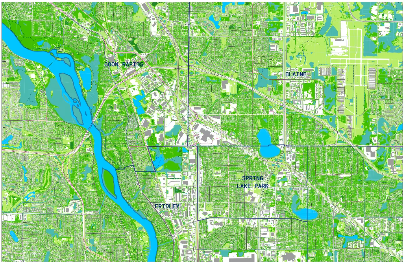
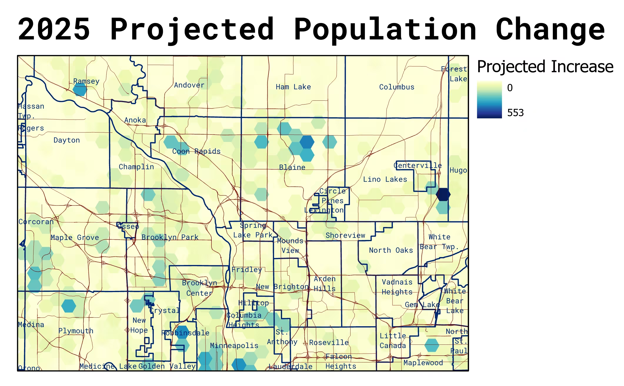
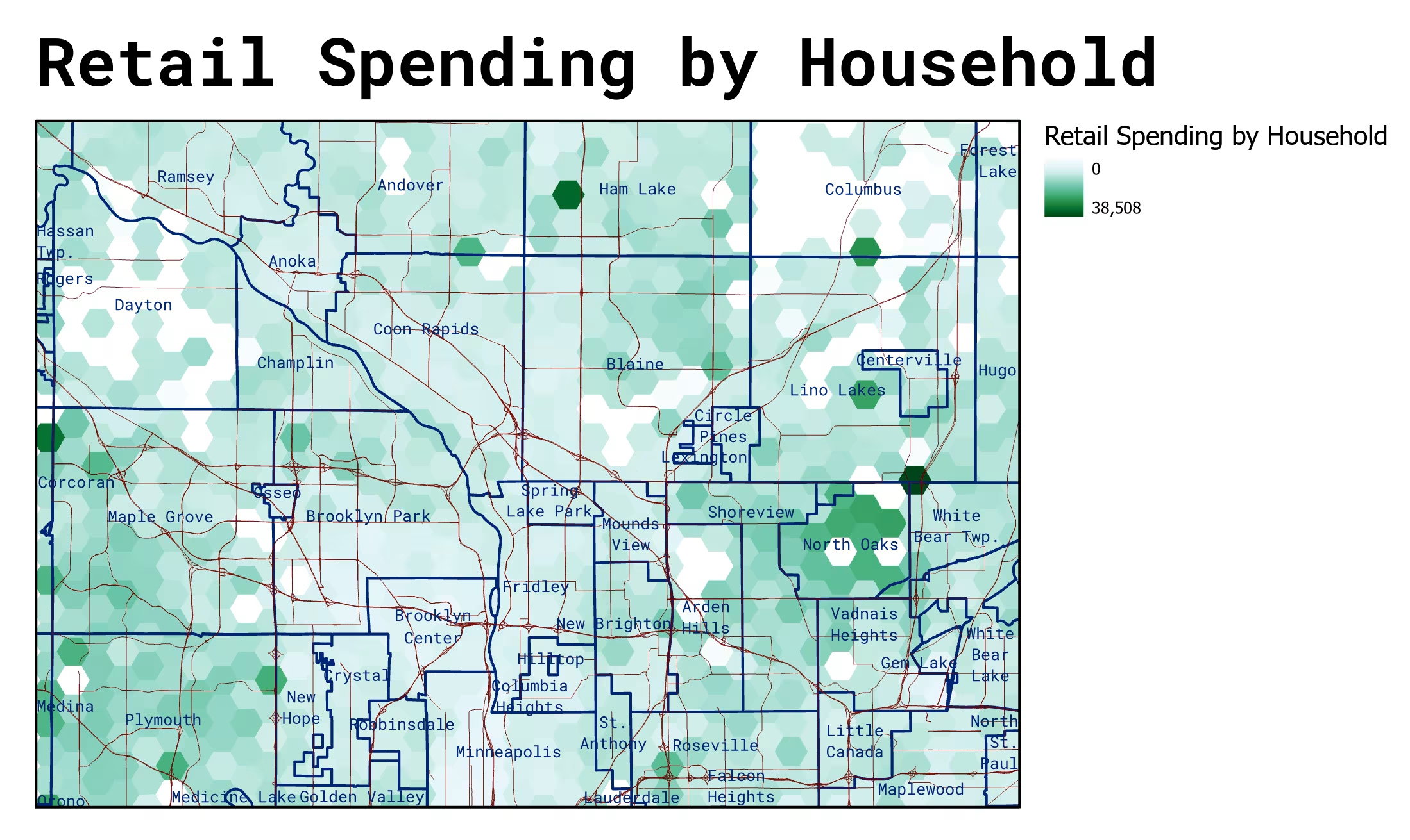
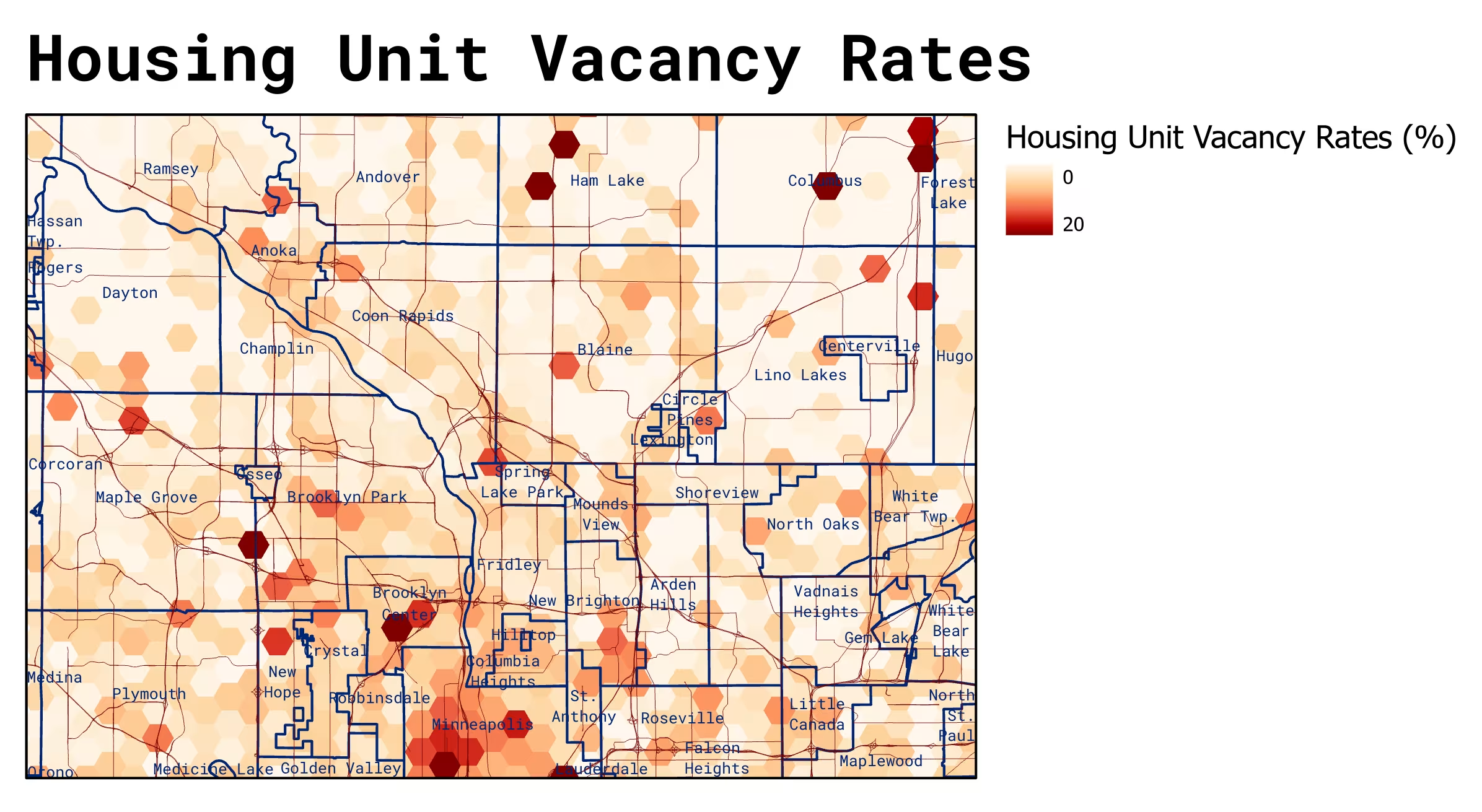
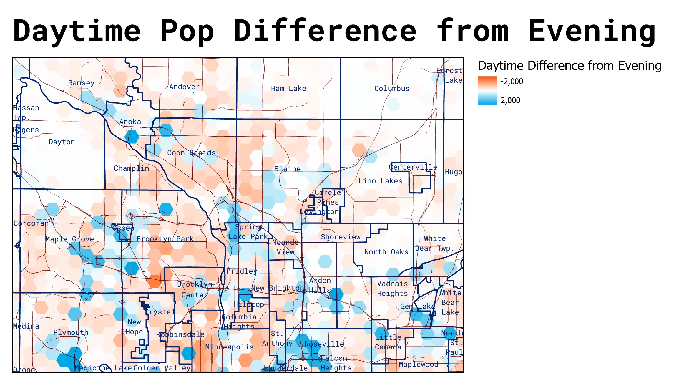
We also regularly use GIS data sources to evaluate sites in the early phases of design. These types of data operate at the urban scale and can reveal important trends and forces acting on the site. Some common types of data we evaluate are population trends and densities, social vulnerability factors and environmental hazards, environmental patterns like tree canopy and wetlands, resiliency risks like flooding and fire, topographic conditions, historical aerial photographs, and general property boundaries.
- Image
- Image
- Image
- Image
- Image


- Image
- Image
- Image
- Image
- Image